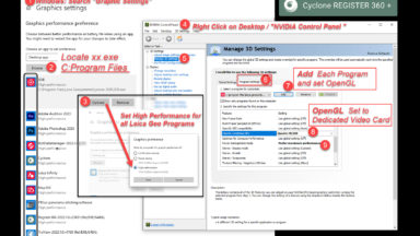
Graphics Settings Required for Leica Geosystems Programs
Required Graphics Setting that need to be set manually for all programs.
This topic covers how to use the Cyclone software from import to extraction.
Required Graphics Setting that need to be set manually for all programs.
How to fix databases that are no loner visible in Cyclone Core?
It it possible to setup a batch routine to import different sets of raw data at one time. Watch the following video to learn how to use the Batch Import in Cyclone Core.
Installation of the Client License Manager (CLM) program is required to use Leica Geosystems programs. After installing the CLM program, make sure you are connected to the internet, open the CLM program, and activate your EID numbers for your software programs. A green bar indicates […]
There are a couple of ways to validate that your BLK360 is operating accurately. Remember it is always recommended to send in your instrument annually to the Leica Geosystems Service Center for calibration. Calibration Field Check Of the two tests that can be done, the […]
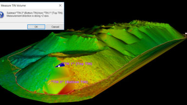
Learn about the measurement tools in Cyclone.

This post goes over how to import a control file into Cyclone and geo-reference the point cloud data.
The following group of videos covers the workflow of processing P-Series data. Topics include import, navigation, registration, geo-reference, layers, codes, target extraction, coordinate systems, data reduction and cleanup.
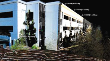
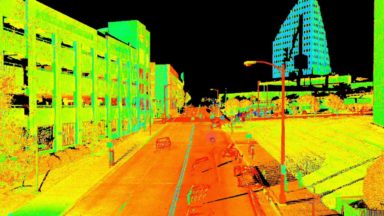
The following videos cover the topographic workflows in Cyclone. The videos, created by Brian Elbe, Sales Manager and Reality Capture Consultant detail the tools and workflows for extracting deliverables out of Cyclone and importing them into CAD. List of Topographic Videos 1. Virtual Surveyor 2. […]