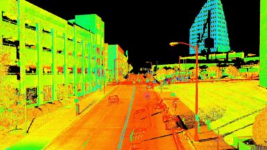
• Home
  • 3D Scanning
    • BLK2GO
    • BLK3D
    • BLK360
    • RTC360
    • P-Series Scanners
    • CloudWorx
    • Cyclone
    • Cyclone 3DR
    • Cyclone Field 360
    • Cyclone REGISTER360
    • JetStream
    • Map360
    • Pointfuse powered by JS
    • TruView
  • Mobile Mapping
    • Hardware
      • Pegasus Backpack
      • Pegasus Two Ultimate
    • Software
      • Inertial Explorer
      • Infinity
      • Pegasus Manager
        • Mission Planning
        • Processing
        • Rail Factory
        • Rail Track Geometry
        • Real Time Data Exchange
        • Road Factory
        • Trajectory Adjustment
        • View Only
      • Pegasus MDA
  • Virtual Training
SMART PLAN
Login Register
Table of Contents
Toggle sidebar & navigation
  • Home
  • 3D Scanning
    • BLK2GO
    • BLK3D
    • BLK360
    • RTC360
    • P-Series Scanners
    • CloudWorx
    • Cyclone
    • Cyclone 3DR
    • Cyclone Field 360
    • Cyclone REGISTER360
    • JetStream
    • Map360
    • Pointfuse powered by JS
    • TruView
  • Mobile Mapping
    • Hardware
      • Pegasus Backpack
      • Pegasus Two Ultimate
    • Software
      • Inertial Explorer
      • Infinity
      • Pegasus Manager
        • Mission Planning
        • Processing
        • Rail Factory
        • Rail Track Geometry
        • Real Time Data Exchange
        • Road Factory
        • Trajectory Adjustment
        • View Only
      • Pegasus MDA
  • Virtual Training
HDSU Smart Plan

Tag / Target Extraction

Apply ControlControl TabFinalizeLogoPublish OptionsReportSetup CloudSmart LabelSurvey ControlTarget ExtractionTarget Label
3D Scanning, Cyclone REGISTER360

Extracting Targets and Registering Data to Control

This video by Brian Elbe covers extracting targets and registering the data to control. It also shows how to finalize a project, edit and publish the registration report and point cloud data.

3D Scanning, Cyclone

Processing Pxx ScanStation Data in Cyclone

The following group of videos covers the workflow of processing P-Series data. Topics include import, navigation, registration, geo-reference, layers, codes, target extraction, coordinate systems, data reduction and cleanup.

© 2020 Leica Geosystems - Part of Hexagon Privacy Policy | Cookie Policy | Code of Business Conduct and Ethics

Designed by WPZOOM