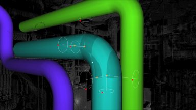
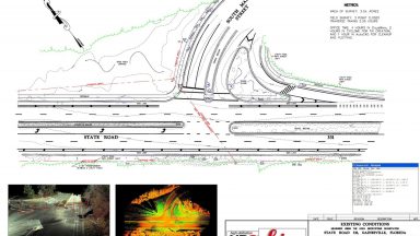
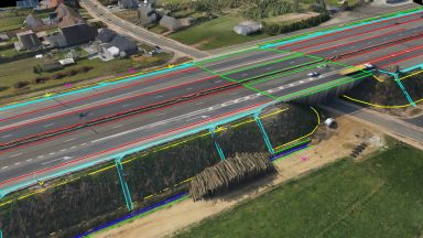
Layers
Layers in Cyclone provide a powerful tool for managing the visibility and selectability of point clouds or modeled objects. Users can import their standard CAD layers into Cyclone using COE.
Commands in Cyclone can be Hot Keyed to any button on the computer’s keyboard to speed up processing. Cyclone installs with a preset list of built-in Hot Keys.
Handles in Cyclone can move, change and rotate the properties of any object. Handles can also be dragged and snapped together.
TINs created in Cyclone are easily exported out as a XML and recognized as a surface in AutoCAD in the Terrain Explorer.
The Edit Properties is dialogue box that can change a multitude of features of modeled objects, lines, polylines and limit boxes in Cyclone.
Virtual Surveyor is an effective and quick method of digitizing points, lines and polygons from the point cloud.
TruView is a free panoramic viewer that allows users to view the point cloud data and image from the scanner position or the scan data from defined camera views.
Cyclone Navigator is the table of contents for the Cyclone program. This menu is used to access and organize the point cloud data, manage tools and settings in the program and create blank databases to import raw data.
Cutplanes are used in Cyclone to create horizontal and vertical slices through the point cloud, modeled objects, and TINs. Cutplanes can be configured for thickness, step interval, set on an object, set to the viewpoint or defined by the Reference Plane.