
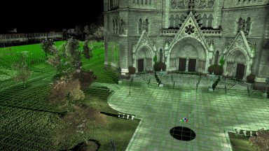
TIN, Sample Grid, & Contours
Existing TINs can be re-sampled to reduce the number of triangles and create an evenly spaced grid of points or mesh over an irregular mesh.
Existing TINs can be re-sampled to reduce the number of triangles and create an evenly spaced grid of points or mesh over an irregular mesh.
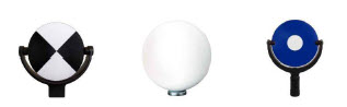
Black and White, Spheres and HDS targets are the three primary types used in the field with the scanners. The P-Series, BLK360 and RTC360 use Black and White and Sphere targets. The C10 can acquire all three types.
Surface deviation is a great tool to see how much one TIN deviates from another.
ScanWorld Explorer is a menu where you can re-load the point cloud after you have modeled, erased, or segmented the cloud. Users can colorize scans position by separate colors.
Removing Noise is an easy way to remove tons of noise on the surface of a point cloud from traffic or other interference.

This section covers other registration techniques other than targets and point clouds to register scans together. It covers techniques such as creating calculated vertexes between planes, and using modeled objects such as pipes and patches.
Reference Planes are extremely helpful tools for Points on a Grid, Alignments, Volumes, 2D Drawing Tools, Modeling and Measurements. Multiple Reference Planes can be created and saved.

Most of Cyclone program settings are found in the Preferences. These can be assessed from Cyclone Navigator or within a ModelSpace View. Changing some of the preferences can enhance program functionality.
A Nested Registration is a techniques that allows users to build registrations from previous ones. Users can combine scans from the first day of field work and then combine the second days work. Then day one and two can be combined together.
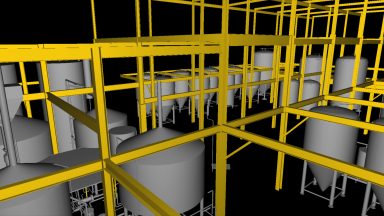
3D Surface Models can be created form the point cloud data in Cyclone. This section covers Piping, Steel, Parts Table, Steel, Patches, Boxes and Cones, Copying and Moving modeled objects